Explore Green Jobs

GIS Manager

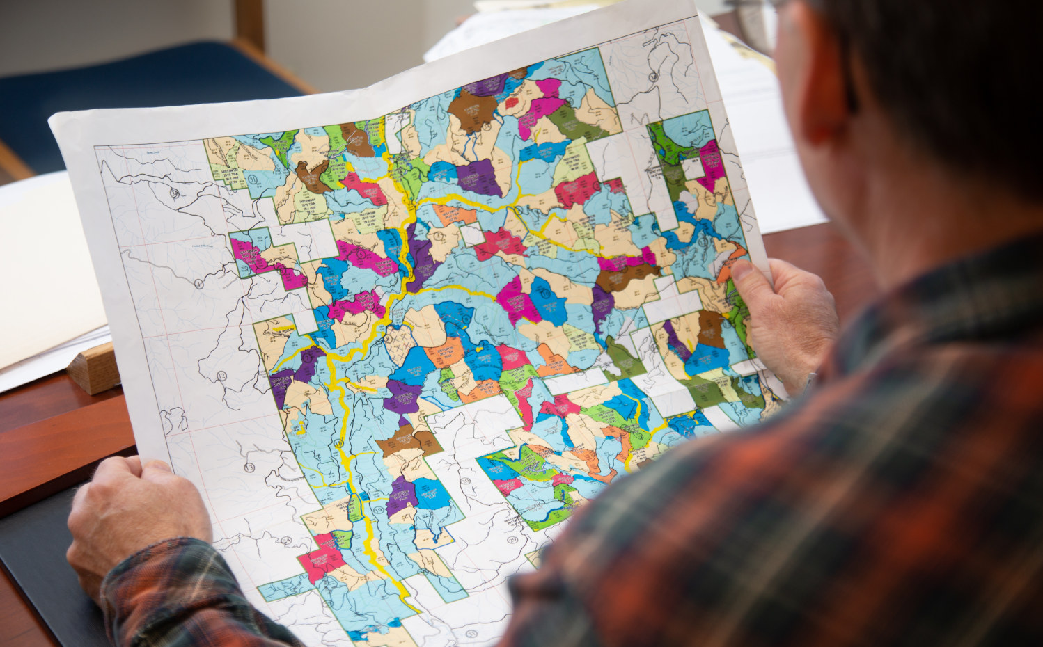
The GIS Manager oversees a team of GIS Specialists responsible for compiling and analyzing forest data. People in this field use GIS (geographic information systems) digital mapping technologies to collect and analyze data, make calculations, create graphs and maps, and much more. This position is an essential part of the management and sustainability of working forests.

GIS is a leading technology in the forestry industry. It allows the forestry organization to organize geographic information into computer databases that are analyzed to make well-informed decisions. This type of information supports all planning efforts, development, and research projects.

Other related GIS positions may include a GIS Specialist, GIS Technician, or GIS Forester.

Boz Boswell

Senior GIS Manager, Rayonier

I enjoy solving technical problems and providing our customers the information they need so they can make good decisions. There is always something different: I can troubleshoot a system issue, design a process to capture new data, help a teammate think through an analysis project, write SQL to query data from a database, and build a webmap for a presentation, all in a single day.

Education

Bachelor’s or Master’s Degree in GIS, geomatics, geography, computer science, or environmental sciences.

Helpful courses to take in high school: Courses that focus on earth science and computers, such as geography, earth science, biology, computer science and physics. In addition to educational classes, hands-on experience in a real-world setting is beneficial. Seek out a GIS graduate certification program or an internship.

Tools of the Trade

  • The primary tools used are GIS digital mapping tools. These tools help the individual organize and understand information about working forests. These mapping tools allow the GIS Manager to analyze forestry patterns, track wildlife, map out the land and measure logging efforts.
  • Satellites and drones are used to acquire additional information (imagery, LiDAR, photography) about the forest for further analysis.
  • Computers and tablets are widely used to collect and analyze data.
  • Maps and graphs are used for the presentation of information about the organization’s assets.
  • Database management (spatial and tabular) skills and tools are common.

Important Skills

It is important to have an understanding of forestry functions like logging operations as well as knowledge about the forest environment and employees and contractors working within the forest.

A GIS Manager may work directly with the inventory team as well as other employees across the company. It is important to be able to understand the needs of the people you work with and determine the right tools to meet those needs. It is helpful to know how to explain technical GIS concepts to non-technical individuals.

Knowledge of statistics and data analysis techniques, as well as an interest in new data capture technologies such as satellites and drones.

Although this job is mainly office-based, there are times when the GIS Manager will work in the forest to collect data. A love for the outdoors and the ability to walk for extended amounts of time is helpful.

Job Responsibilities

In this field, the GIS Manager ensures that all corporate data is obtained, analyzed correctly, and delivered in a timely manner. GIS Managers oversee the systems, spatial information, and tabular information collected by the organization. In managing the geographic information systems (GIS), the work performed by the GIS Manager and his/her team supports most of the organization’s activities, including forest management, facilities management, infrastructure management, development activities, and more.

Much of the information GIS Managers and Specialists collect and analyze directly affects the establishment of forests, reforestation efforts, harvest planning, and even helicopter spraying. This role is directly linked to many aspects of the forestry company, including management and inventory teams.